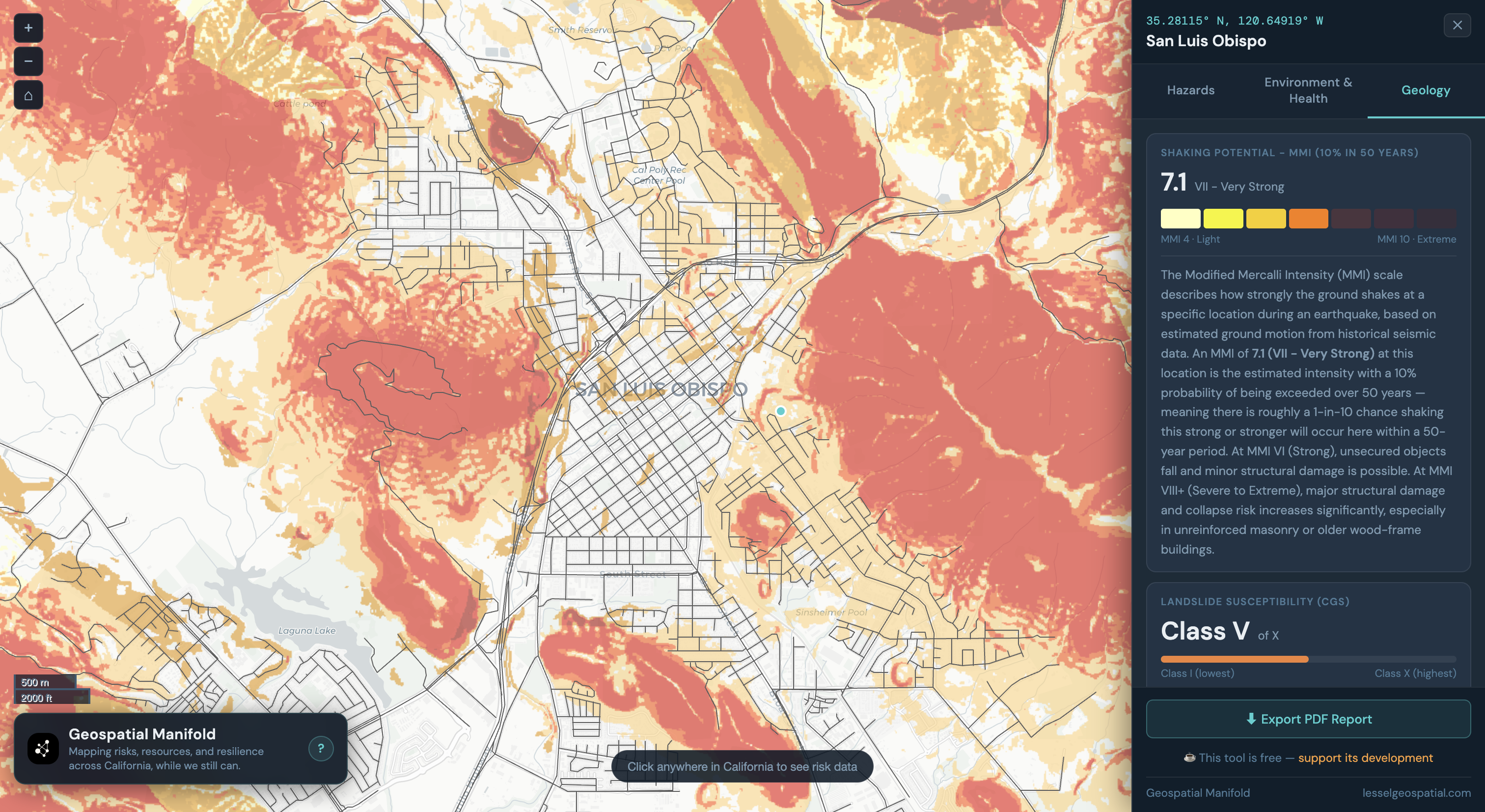
Geospatial research & tools

Someone has to
map this mess.

Turns out everything has coordinates.

Building open-source tools and research at the intersection of remote sensing, disaster risk, and urban resilience.

Published inScience & IJRS
Experience14+ Years
Former FellowNASA DEVELOP
BackgroundGeology + GIS + Remote Sensing
Projects
Geospatial Manifold — seismic hazard map of San Luis Obispo
Risk analysis tool

Geospatial Manifold

A pre-disaster urban resilience auditing platform for city planners. Analyzes road network vulnerability and identifies critical failure points before disaster strikes, not after.
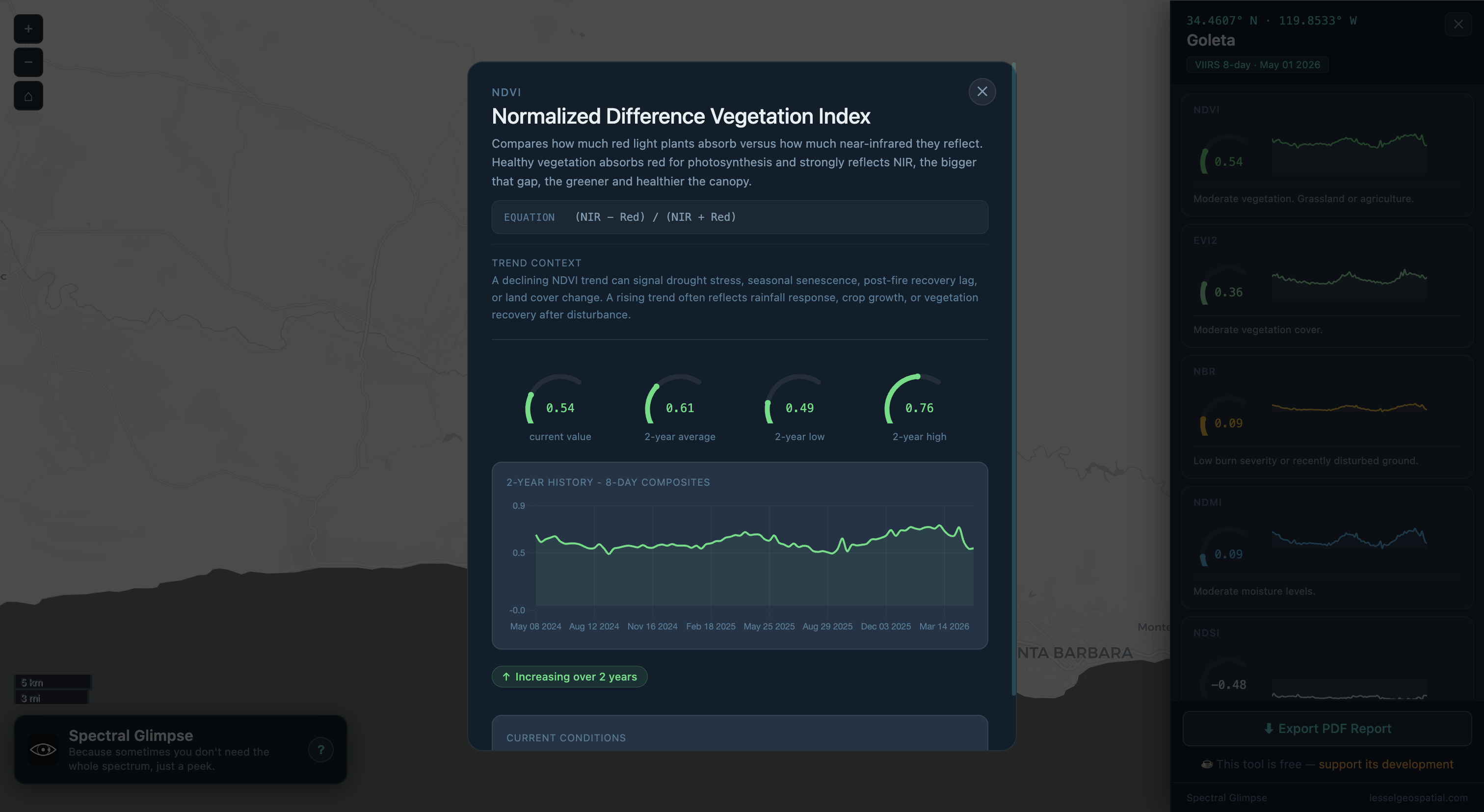
Leaflet CAL FIRE Python Urban Planning Disaster Risk
Spectral Glimpse — NDVI panel over Santa Barbara
Spectral indices analysis tool

Spectral Glimpse

Because sometimes you don't need the whole spectrum, just a peek. An on-demand spectral index platform for California. Click any point on the map to sample six satellite-derived indices with two years of 8-day history. Powered by NASA VIIRS data, updated automatically every 8 days.
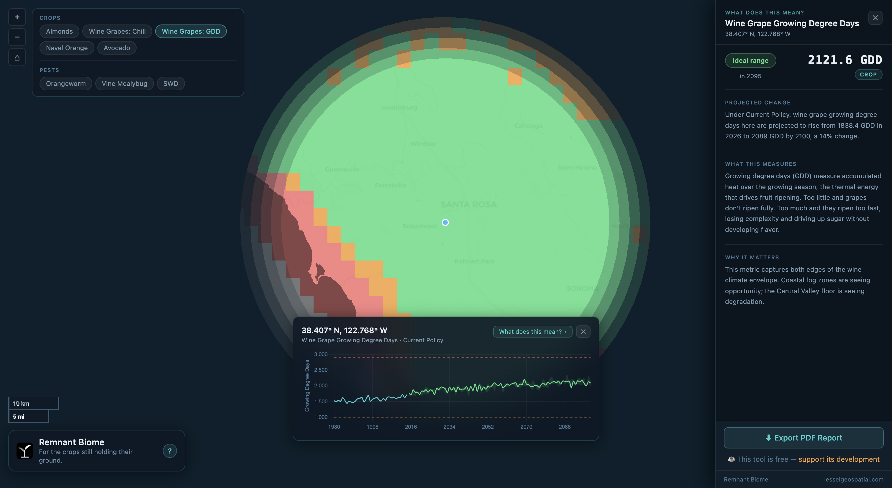
NASA VIIRS Cloud-Optimized GeoTIFF Cloud Run Remote Sensing Cloudflare
Remnant Biome — wine grape growing degree days viability map
Agricultural viability tool

Remnant Biome

Mapping how California's agricultural viability zones are shifting under climate change, from 1980 to 2100. Explore seven derived climate metrics across four crops and three pests, computed from LOCA2-Hybrid downscaled climate projections under multiple emissions scenarios. A static, no-backend tool built on precomputed data underpinning the Fifth California Climate Assessment.

LOCA2-Hybrid CMIP6 MapLibre GL JS Climate Change California Agriculture
Daily briefing

Project Geoganda

A daily geospatial news briefing with an agenda, to find the ground truth in geospatial news. Curated by AI, filtered by taste, delivered with a slight edge.

Daily Remote Sensing Disaster Risk Urban Planning Climate
About

Jerrod Lessel is a senior geospatial analyst and remote sensing researcher with deep experience in production-scale satellite imagery analysis, climate monitoring, and spatial modeling.

Previously at Gro Intelligence for eight years, building crop classification systems, flood and drought monitoring pipelines, and remote sensing methodology across dozens of countries using Google Earth Engine. Former fellow with NASA DEVELOP and research staff at Columbia University's International Research Institute for Climate and Society. Currently a Senior Geospatial Data Scientist and Modeler at Caltrans.

Publications